Do you know that there is a place in India that Bangladeshis can access without a passport? The Tin Bigha corridor, a strip of land which measures 178 meters X 85 meters, is that place. It is located in the southeast corner of Mekhliganj Block in the Cooch Behar District of West Bengal, India.
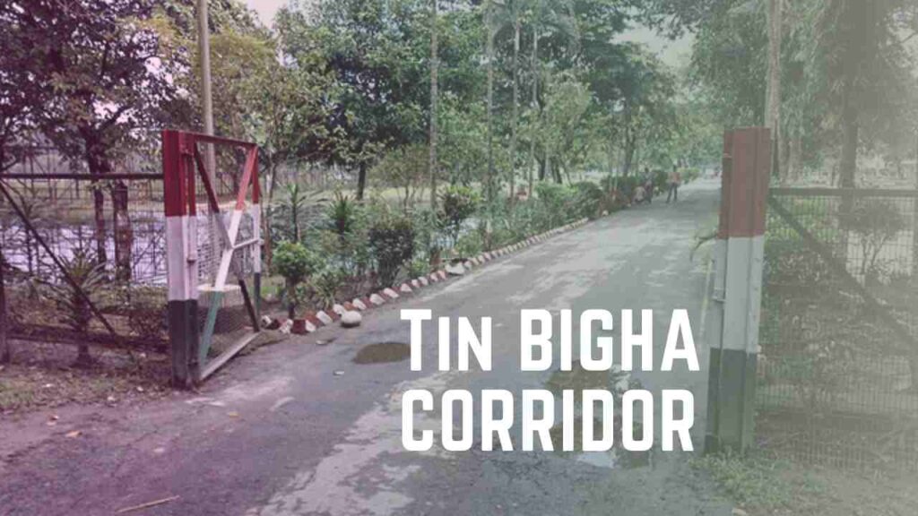
But why this arrangement is done? To help the villagers of Dahagram and Angarpota, two Bangladeshi enclaves within the Indian territory. This strip of land is the only channel of communication for the two villages to get access to their homeland Bangladesh.
History Of Enclaves In India And Bangladesh
Enclaves are fragments of a country totally surrounded by another country. The people in the enclaves are totally surrounded by people of a foreign country and do not have access to the mainland of their mother country.
After partition, India had 102 enclaves in Bangladesh while the latter had 71 enclaves in India along the border with West Bengal. But, why did such a situation arise? Well, to understand this, one has to open the chapters of the partition of India.
A lot of enclaves near the India-Bangladesh border were under the control of the kingdom of Cooch Behar and Rangpur, who ruled over the area. Before the partition of Bengal, the enclave dwellers had no trouble, in any matter, as access was free. After the partition of India in 1947, Rangpur became part of East Pakistan(present-day Bangladesh). The princely state, Cooch Behar, merged with the Indian Union in 1949. With the introduction of the passport system, the inhabitants were subjected to many problems.
Before the merger of the kingdom, the Bengal Boundary Commission was constituted, under the chairmanship of Sir Cyril Radcliffe in 1947. The Boundary Commission’s main goal was to demarcate the boundaries between the two parts of Bengal based on determining the contiguous areas of Muslim and non-Muslim people as well as other factors.
These enclaves along the border of West Bengal and Bangladesh are a result of the hasty job done by Sir Cyril Radcliffe.
Politics Of Tin Bigha Corridor
As the enclaves were within each other’s territory, access to the mainland was a problem for the residents. Due to the regions’ limited development, access to education and medical facilities was a concern. The smugglers and dacoits taking haven in these enclaves gave rise to serious crime problems.
In 1958, Jawaharlal Nehru and the Pakistani PM Feroze Khan Noon had an agreement for the disputed enclaves. After the formation of Bangladesh in 1971, Indira Gandhi and Sheikh Mujibur Rehman signed a pact in 1974 to address the enclave issue.
After the deal between Gandhi and Mujibur Rehman, the Tin Bigha corridor was supposed to be handed over to Bangladesh in 1974 itself. While Bangladesh immediately handed over South Berubari, the Tin Bigha could not be handed over because a constitutional amendment was required. It delayed the process, and only in 1992, the area was leased to Bangladesh.
The Tinbigha corridor was inaugurated on June 26, 1992, in accordance with an agreement between the governments of India and Bangladesh.
When the area was opened up that year, Bangladeshis were able to move through the corridor for 6 hours(every alternate hour from 06:00hrs. to 18:00hrs) per day. In July 1996, it was opened up for 12 hours(06:00hrs. to 18:00hrs) a day. Despite this, the people of Dahagram–Angarpota were still captives, in the sense that timely access to basic facilities was still a problem.
Finally, on October 19th, 2011, the corridor opened for 24 hours, bringing relief and joy to the dwellers of these Bangladeshi enclaves.
In May 2015, the historic Constitution (119th Amendment) Bill was passed by the Parliament of India that allowed the exchange of enclaves by India and Bangladesh. Also, the long-standing problem of people living in a stateless situation came to an end.
Since the exchange of territory took place, the only remaining enclave is Dahagram–Angarpota, an enclave of Bangladesh.
Reaction Of Local Indians On Tin Bigha Corridor
Indian people, in general, were not happy with the Tinbigha Agreement for allowing transit facilities through the corridor to Bangladeshi people without any sanction of the problems of Indian enclaves. The people residing in Kuchlibari are aggrieved because they are facing inconveniences in their movement due to the traffic movement for Bangladesh through the corridor.
The extension of the time limit for Bangladeshis was opposed by some local Indian people under the banner of Sangram Samity, Kuchlibari.
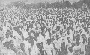
There were massive protests from the people residing in the surrounding areas. Two people were also killed. Indian people every year observe Sahid Dibash on 26th June adjacent to Tinbigha to commemorate the deaths of those who died over Tinbigha agitation.
Geographical Location Of Tin Bigha Corridor
Fulkadabri Gram Panchayat (in the north) and Kuchlibari Gram Panchayat (in the south), both in India, and Dahagram (in the west) and Panbari Mouza (in the east), both in Bangladesh, form the corridor’s geographical boundaries.
Dahagram and Angarpota, both the enclaves, are administered as part of Lalmonirhat Zila and fall within the jurisdiction of Patgram police Station of Bangladesh. The Tin Bigha strip holds an important position, as this is the only channel of communication for the two Bangladeshi villages with their homeland. The enclave covers 25.95 km2 (10.02 sq mi) and has a population of 20,000 people. Tin Bigha Corridor is the lifeline for the villagers of the enclave. It enables its residents to connect with their mainland.
Border Security Forces (BSF) of India and Border Guards Bangladesh(BGB) of Bangladesh guard the Tin Bigha Corridor.